Team: 3 members
Task: To develop a Bebauungsplan (land-use development plan) for a neighborhood in the eastern part of Berlin.
Overview
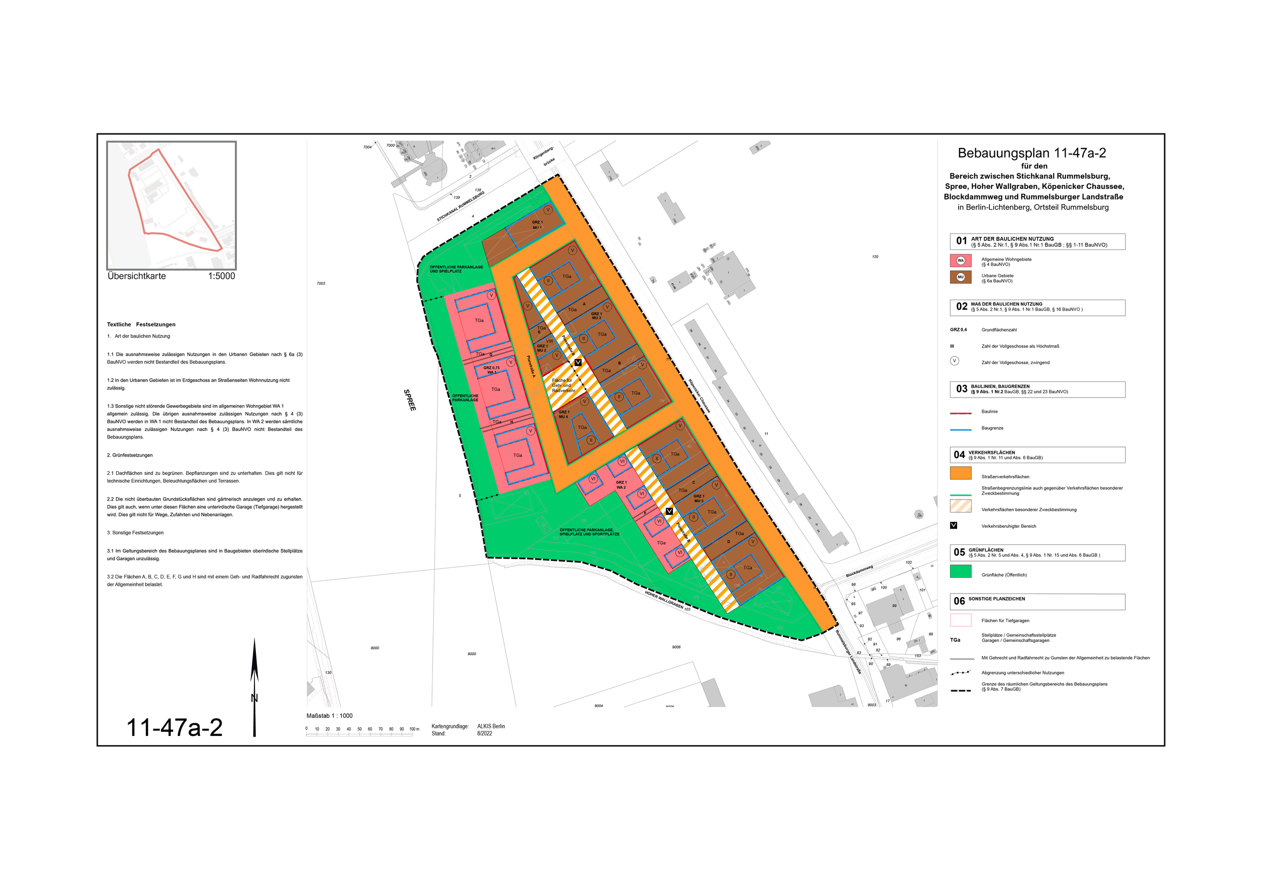
This project/class involved designing a Bebauungsplan, a legally binding land-use plan as per the German Building Code (Baugesetzbuch, BauGB), for a specific urban neighborhood in western Berlin. The plan regulates land use, building parameters, circulation, and open spaces to guide sustainable urban development.
My Role
My primary responsibilities were:
Conceptualizing the planning area, defining the exact boundaries and spatial extent to be illustrated.
Creating the Übersichtkarte (overview map) situating the area within the urban context.
Writing the Justification (Begründung) report explaining the planning decisions and urban goals.
Drafting the explanatory text accompanying the project documentation (including Part A – Plan drawing, Part B – Regulations, and the Begründung).
Designing and editing the legend, ensuring all symbols comply with the official Planzeichenverordnung (plan symbol ordinance).
Project Components
The Bebauungsplan was structured according to the following components:
Part A – Plan Drawing (Planzeichnung):
The visual representation of the planning area, including zoning for residential, commercial, green spaces, traffic routes, and building plots (Baufenster). Boundaries and permitted land uses were clearly delineated.Part B – Regulations (Festsetzungen):
Textual descriptions of land-use types (Art der baulichen Nutzung), building parameters such as Grundflächenzahl (GRZ) and Geschossflächenzahl (GFZ), building methods (open or closed Bauweise), and stipulations for green and traffic areas.Begründung (Justification):
A detailed written explanation of the planning objectives, rationale for zoning decisions, density control measures, and anticipated social and environmental impacts. This section also included compliance with legal requirements for environmental assessments under § 2 Abs. 4 BauGB.Legend:
Standardized symbols and color codes following Planzeichenverordnung, with clear explanations of zoning, permitted uses, and other spatial designations.